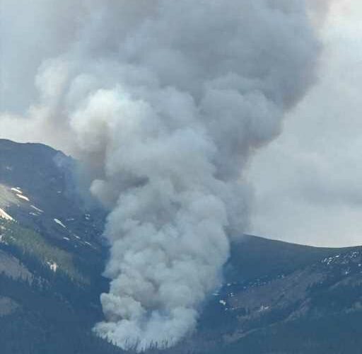
Colorado wildfires: Red flag conditions could complicate Devil’s Thumb
Rainfall helped firefighters control the Devil’s Thumb fire burning on 95 acres northeast of Fraser in the Indian Peaks Wilderness, which on Thursday morning was deemed 10% contained, according to U.S. Forest Service officials.
Lightning likely ignited this fire but the cause remains under investigation, Forest Service officials said in their latest posting on Twitter. Grand County Sheriff officials urged people to avoid the area.
No evacuation orders had been issued around Fraser. The fire apparently began Tuesday in the wilderness near the Devil’s Thumb Trailhead, about 7 miles northeast of Fraser. It was burning in forests where mountain pine beetles have killed trees and wind has blown dead trees down to the ground.
Forest Service officials declared “a full suppression” approach to the fire, even though it was burning in the wilderness.
It is one of five fires burning around western Colorado. The National Weather Service on Thursday issued a “red flag” fire danger warning in western Colorado as warm, dry, and windy conditions favored flames.
Spring Creek fire
Firefighters south of Parachute still were battling the 2,940-acre Spring Creek fire that broke out around June 24 on private land in Garfield County, now 37% contained. More than 500 firefighters, with air support, were trying to attack flames and hotspots. A community meeting was scheduled for 6 p.m. Thursday in Parachute.
The proximity to oil and gas industry wells and other infrastructure has complicated firefighting, forcing crews to carry monitors to detect hydrogen sulfide or other toxic and flammable gases that could be released if flames reach industrial facilities. No injuries were reported. The cause hasn’t been determined. No evacuations were ordered.
Coal Mine fire
In southwestern Colorado, the Coal Mine fire in Archuleta County has burned across 286 acres, about 18 miles north of Pagosa Springs. Firefighters were focused on smoking hotspots in the interior of the burn zone. It was listed as 95% contained.
Chris Mountain fire
About 12 miles west of Pagosa Springs, the Chris Mountain fire expanded, burning on 500 acres, and was 35% contained, according to the latest federal agency data. It was burning in forested terrain. A total of 555 firefighters were deployed. Homes in the area were evacuated. Authorities said lightning ignited the fire.
Firefighters faced “critical fire conditions Thursday as they worked to contain and suppress flames in the San Juan National Forest. “The weather forecast includes cooler conditions, and slightly higher relative humidity, but the ridge-top winds increase to 40 miles per hour,” supervisors said in the latest data update, also referring to potential thunderstorms that could bring lightning. “Critical fire weather conditions may be present that would support large fire growth.”
Arkansas Loop fire
Another fire was burning 25 miles east of Ignacio. This Arkansas Loop fire, on Southern Ute land, had burned across 127 acres and was 50% contained, according to the latest information on the federal fire data site. Lightning sparked the fire. Firefighting coordinators estimated the fire will be fully contained by Saturday.
Source: Read Full Article

